Detailed description

Leaflet | © OpenStreetMap
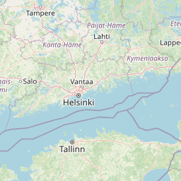
24.70 59.22, 25.09 59.43
Identity Description
| Title | Pattick Byy st:Johannes Hoff tillhörigt uthi Dstrichten Harian och St:Jörgens Kirchspiel Belägen |
|---|---|
| Map type | Single sheet map |
| Reference code | EAA.1.2.C-I-22 sheet 1 |
Notes
Stiliseeritud leppemärkidega eristatud talukohad, punktiga kujutatud vabadike talud(?); mõisapiirid ja piiripunktid; teedevõrk, sooteed, suuremad teed(?) (leppemärk: paralleelsed ristitriibud pikkupidi läbi kriipsutatud), aiad; kõlvikute omandijaotus; vetevõrk; illustreeritud kompass-roos, graafiline mõõtkava
Creators
| Firstname | Lastname | Occupation of cartographer | Creators position |
|---|---|---|---|
| Erich | Reuter | cartographer |
Cartographical and Publishing Description
| Main subject | Not set |
|---|---|
| Material designaton | plan |
| Manuscript/Printed | manuscript original |
| Created | 1697 |
Components and Mathematical Description
| Components | explication, illustrated, compass, graphical scale |
|---|---|
| Azimuth | Not set |
| Textual scale | Scala Ulnarum Svecicarum; 1600 = 11,9 cm |
| Relative scale | 8250 |
Geographical Description
| Admin unit | Specification |
|---|---|
| Estonia (to 1917) / Estonia Guberniya / Harju County / Jüri Parish | Patika |
Physical Description
| Storage form | streched |
|---|---|
| Material and mounting | paper |
| Medium | ink+coloured |
| Dimensions (cm) | 75x85/A0 |
| Access-restrictions | No access restriction |