Detailed description

Leaflet | © OpenStreetMap
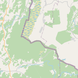
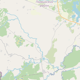
27.32 57.51, 27.70 57.60
Identity Description
| Title | Petserimaal, Laura vallas asuva Ramshino puustusest eraldatud maatuki No 1 plaan |
|---|---|
| Map type | Single sheet map |
| Reference code | EAA.3416.5.4572 |
Creators
| Firstname | Lastname | Occupation of cartographer | Creators position |
|---|---|---|---|
| Ivan | Bessonov | maamõõtja-insener | cartographer |
Cartographical and Publishing Description
| Main subject | Not set |
|---|---|
| Material designaton | plan |
| Manuscript/Printed | manuscript original |
| Created | 1928 |
Components and Mathematical Description
| Components | explication, grid lines, compass, graphical scale |
|---|---|
| Azimuth | Not set |
| Textual scale | 1:2000 |
| Relative scale | 2000 |
Geographical Description
| Admin unit | Specification |
|---|---|
| Estonia (1917-1950) / Petseri County (1919-1944) / Lõuna (until 1938 Laura) Commune (1922-1944) | Petseri mk, Ramshino |
Physical Description
| Storage form | in binding |
|---|---|
| Material and mounting | paper+textile |
| Medium | ink+coloured |
| Dimensions (cm) | 45x26/A2 |
| Access-restrictions | No access restriction |