Detailed description


Leaflet | © OpenStreetMap
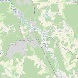
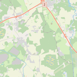
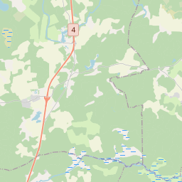
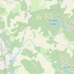
24.63066 59.18571, 24.69933 59.24264
Identity Description
| Title | Suttlem i Haggers Sochen |
|---|---|
| Map type | Single sheet map |
| Reference code | EAA.1.2.C-II-33 sheet 1 |
Notes
Stiliseeritud leppemärkidega eristatud talukohad, kõrtsid; mõisapiirid; ja piiripunktid; teedevõrk; talukõlvikute omandijaotus; vetevõrk; illustreeritud kompass-roos, graafiline mõõtkava.
Creators
| Firstname | Lastname | Occupation of cartographer | Creators position |
|---|---|---|---|
| Axell | Holm | maamõõtja | cartographer |
Cartographical and Publishing Description
| Main subject | Not set |
|---|---|
| Material designaton | plan |
| Manuscript/Printed | manuscript original |
| Created | 1691 |
Components and Mathematical Description
| Components | explication, illustrated, compass, graphical scale |
|---|---|
| Azimuth | Not set |
| Textual scale | 1500 küünart = 11,1 cm |
| Relative scale | 8250 |
Geographical Description
| Admin unit | Specification |
|---|---|
| Estonia (to 1917) / Estonia Guberniya / Harju County / Hageri Parish / Sutlema Manor | Keila jõgi, Luige, Pagavere, Roobuka, Aespa, Kivisilla |
NB! location is approximate
Physical Description
| Storage form | streched |
|---|---|
| Material and mounting | paper |
| Medium | ink+coloured |
| Dimensions (cm) | 101x58/A0 |
| Access-restrictions | No access restriction |
Maps referred to by this map
| Reference code | Relation |
|---|---|
| EAA.1.2.C-IV-27 | rough draft |